Second hike and camp of our four-days-trip in the Alps in june 2019 (after the Bramant lake and before the Thabor / Sainte-Marguerite lakes), the Goléon lake was just the perfect place for this kind of trip. It is a wild and vast plateau at more than 2400m high with plenty of walks and off-trails possibilities, and it is reachable after a “regular” ascent of more than 500 meters of elevation gain in less than two hours. A must-do for every wild camp lover ! And if you prefer a warmer night there is also the Goléon refuge not far from the lake so everybody can find a way of spending a night here.
Actually, I saved this location on top on my “family list” to be one of the first mountain camps we will do the four of us when our second child will be ready to hike by himself. He is two right now, and his sister is capable of this kind of hikes since she was three and a half (of course with the help of hour hand in steep parts and a lot of support and resting breaks). So maybe in a year or two.
The hike starts at Valfroide village at the end of the unpaved road. From there it takes two hours – less with no bags – to reach the lake. Valfroide is the starting point for off-season periods only. In summer the road to the village is closed to public and the hike starts at Les Hières, another village located 30 minutes of hiking before Valfroide. The additional part to hike in summer is almost flat so it will had times but won’t ask hikers a huge additional effort.
On the day of june we hiked the Goléon lake trail the weather was really warm with a non refreshing wind that didn’t helped us enjoy the ascent under the sun. As we always do during our “hike and camp trips” we hiked back from Bramant lake in the morning, then drove to Valfroide in the afternoon and started the hike around 4pm when everybody is leaving the area and when the weather is supposed to be cooler.
The hikes starts by an almost flat path that leads through few summer houses and wild flowers fields. After this part it continues on a larger and rocky path where the slope begins slowly. I remember than on that day we were already wet and thirsty on this easy first part of the hike ! Thanks to this warm air and the wind which was in our back and not in front of us. Yes sometimes it happens : you really prefer to hike facing the wind than having it in your back !
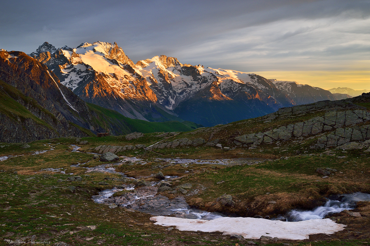
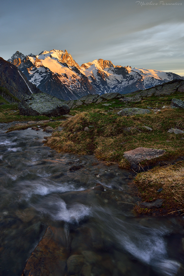
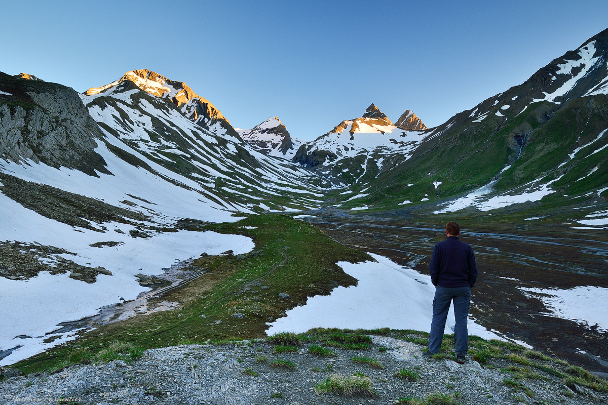
The second part of the hike is the real ascent. It looks like a wall seen from the bottom and even if it is something classic in the Alps, with a really warm weather with no wind to help us to breath we really feeled that we were climbing a wall ! The more you hike up through the zigzags of the trail the more the Ecrins summits reveal binhind us and it is the best thing with this hike : you have THIS view at every turn and it is just so rewarding of the effort.
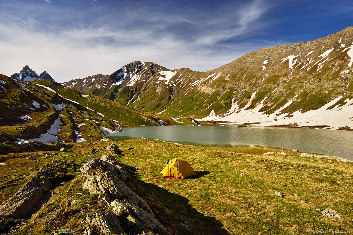
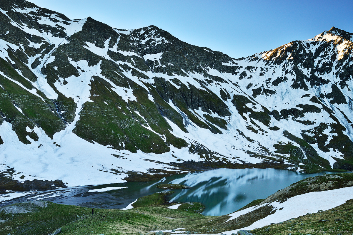
The Goléon refuge is the first to appears to hikers because is is located on a small hill that surrounds the lake and the trail end. Sometimes when a refuge is close to a lake it is not so easy to find a nice spot to enjoy the night but here the place is just awesome : there are large fields to pick-up a tent, and the refuge is away from lake shores (but not so far if you want to enjoy a drink or something else).
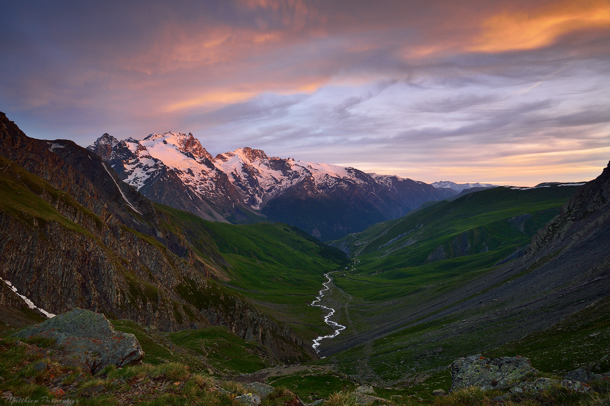
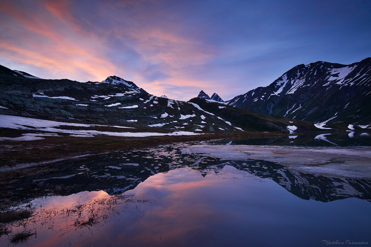
After we set-up our tent we started to do our “photography session” my cousin and I, and I was not really confident about having nice colours that night. Warm or hot weather is really not the best for colors nice moods. Finally we were surprised to see some clouds appearing at the end of the day and making the sky red at the same moment than Ecrins summits were under the last light.
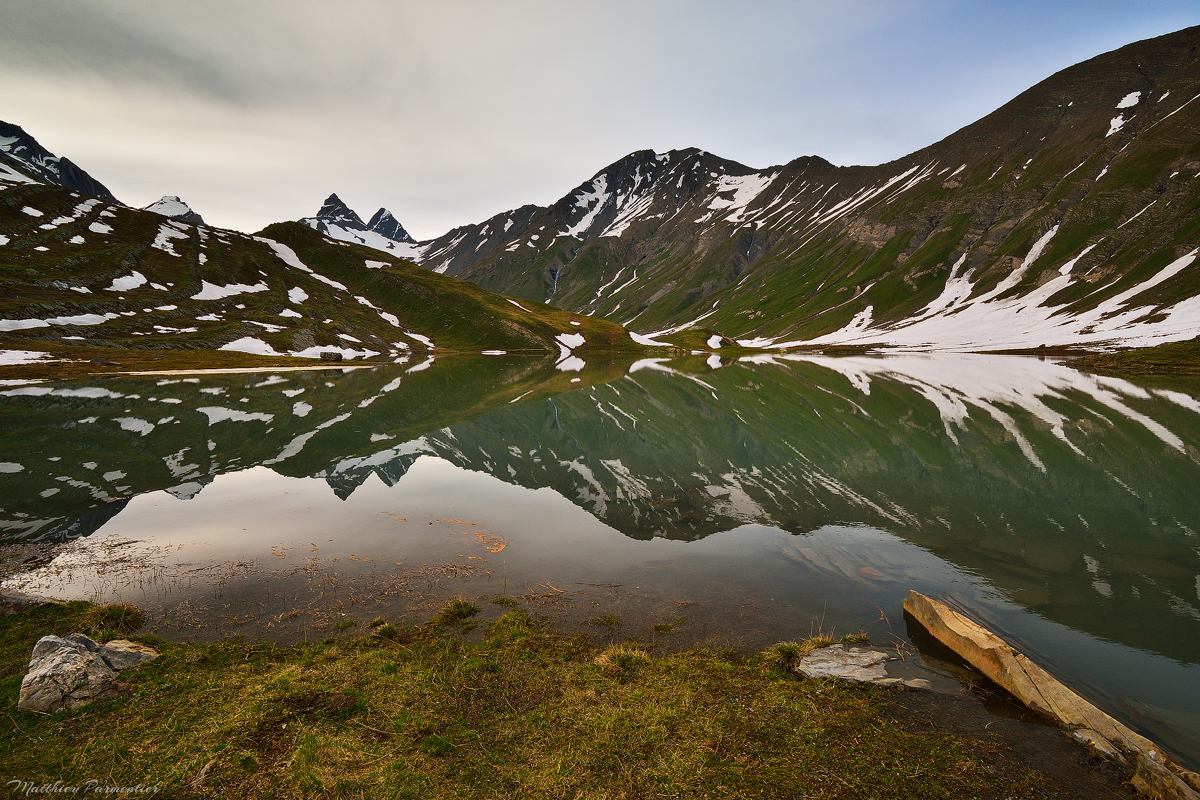
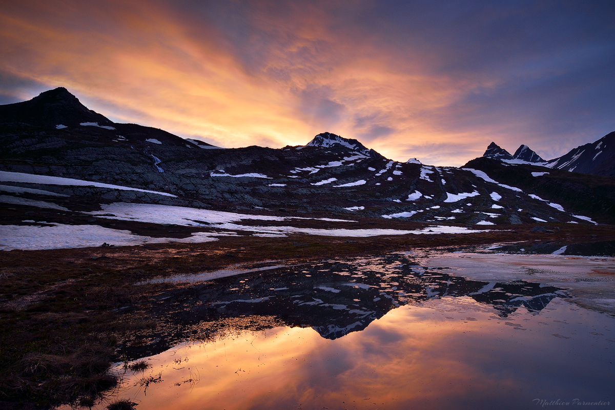
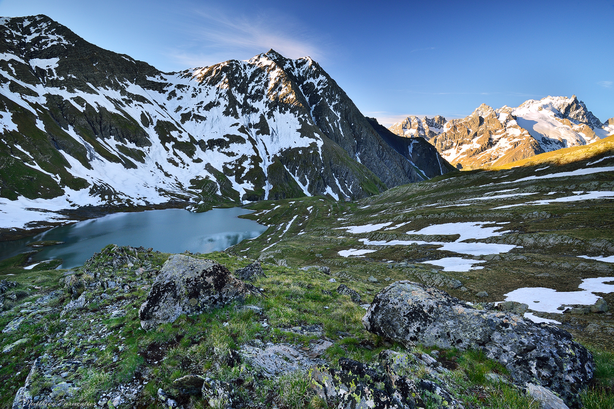
Lucky us we also had a short but impressive sky explosion above the Aiguilles d’Arves and the show of the peaks reflecting in the Goléon lake was just a perfect end for the day. Funny to think that in the morning we were also enjoying a view to the same needles but on the opposite side (see Bramant lake hike).
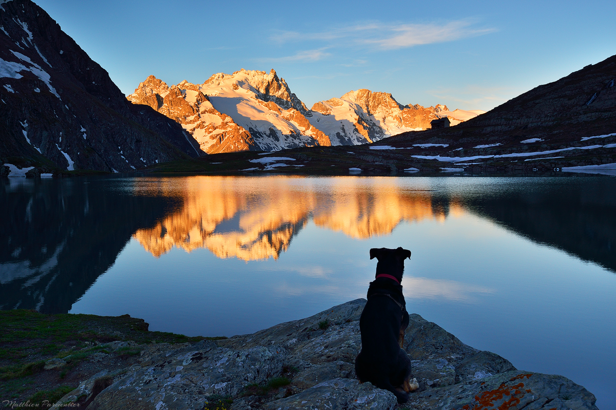
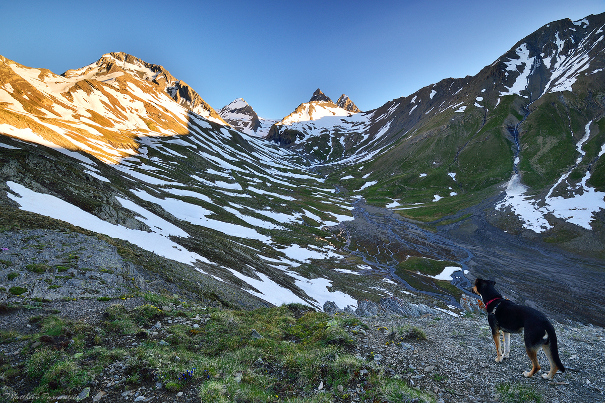
In the morning I woke up for the sunrise and decided to explore the other side of the lake. From there you can enjoy Ecrins summits reflection in the lake. The image above with my dog is the “classic view” of the place and I have to admit that the Goléon refuge is perfectly located in the area. It gives a sense of scale in the landscape and it is also small in this huge and vast compared to these big mountains.
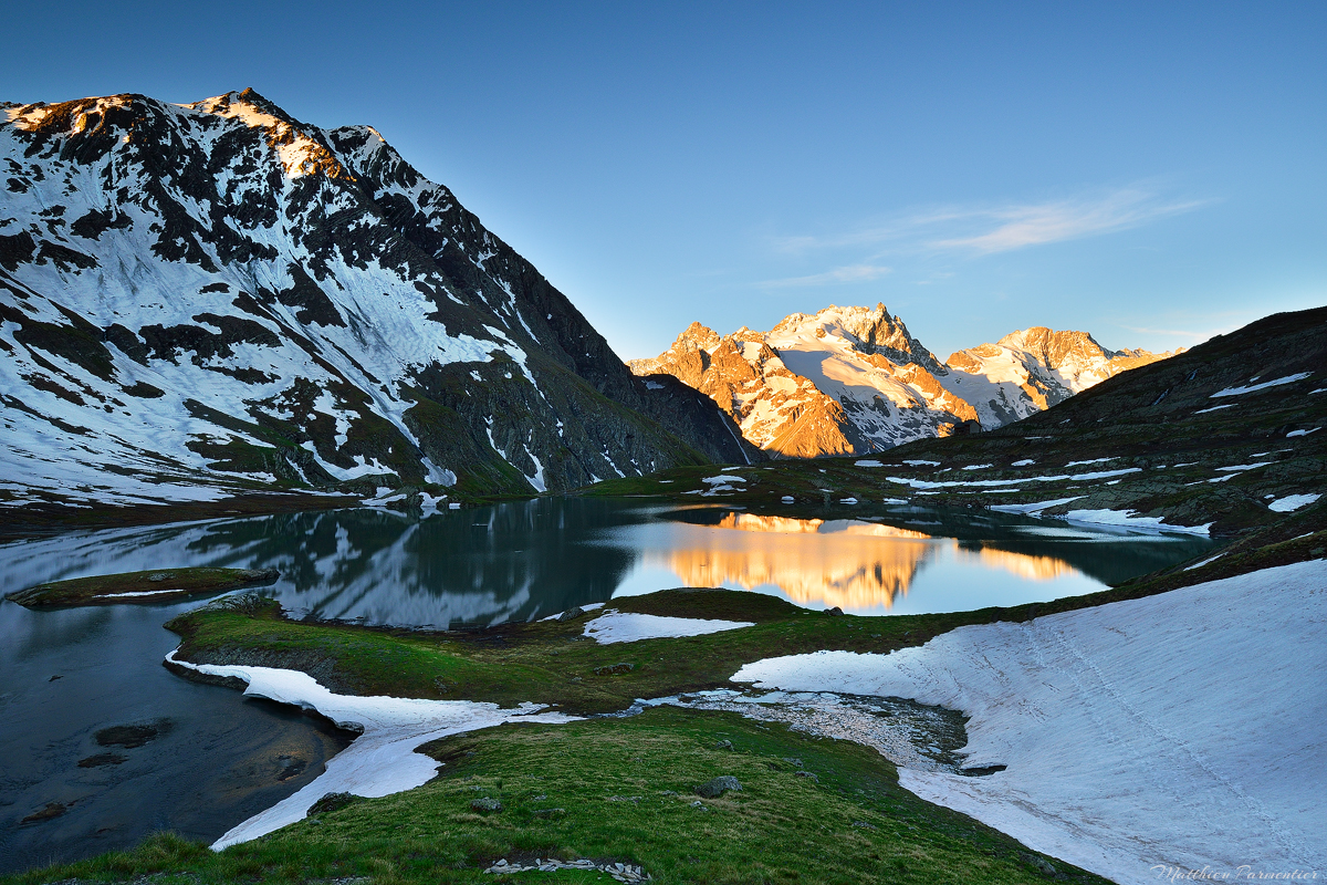
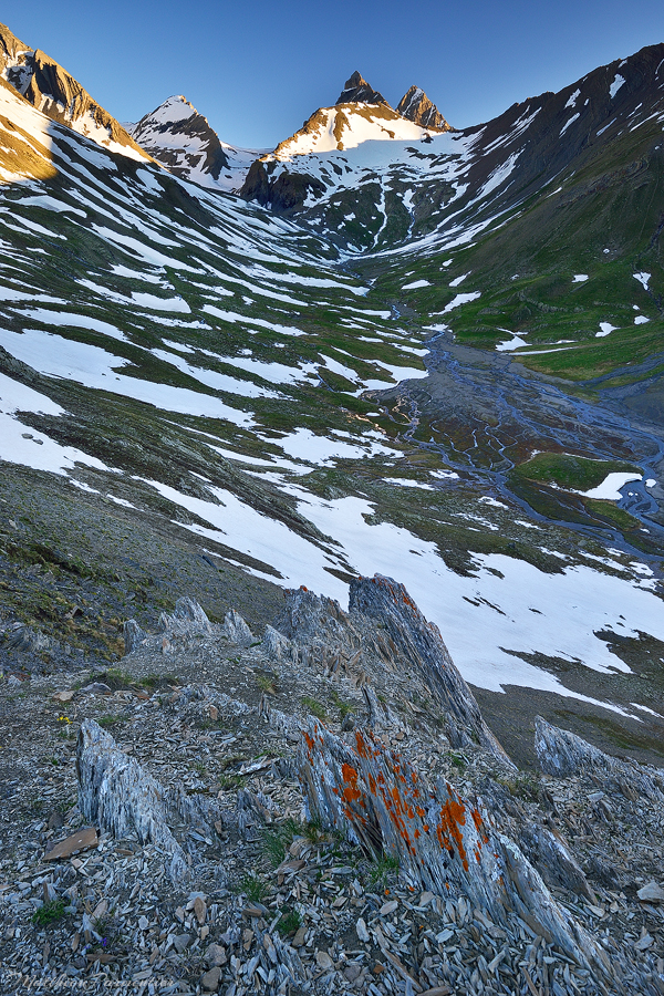
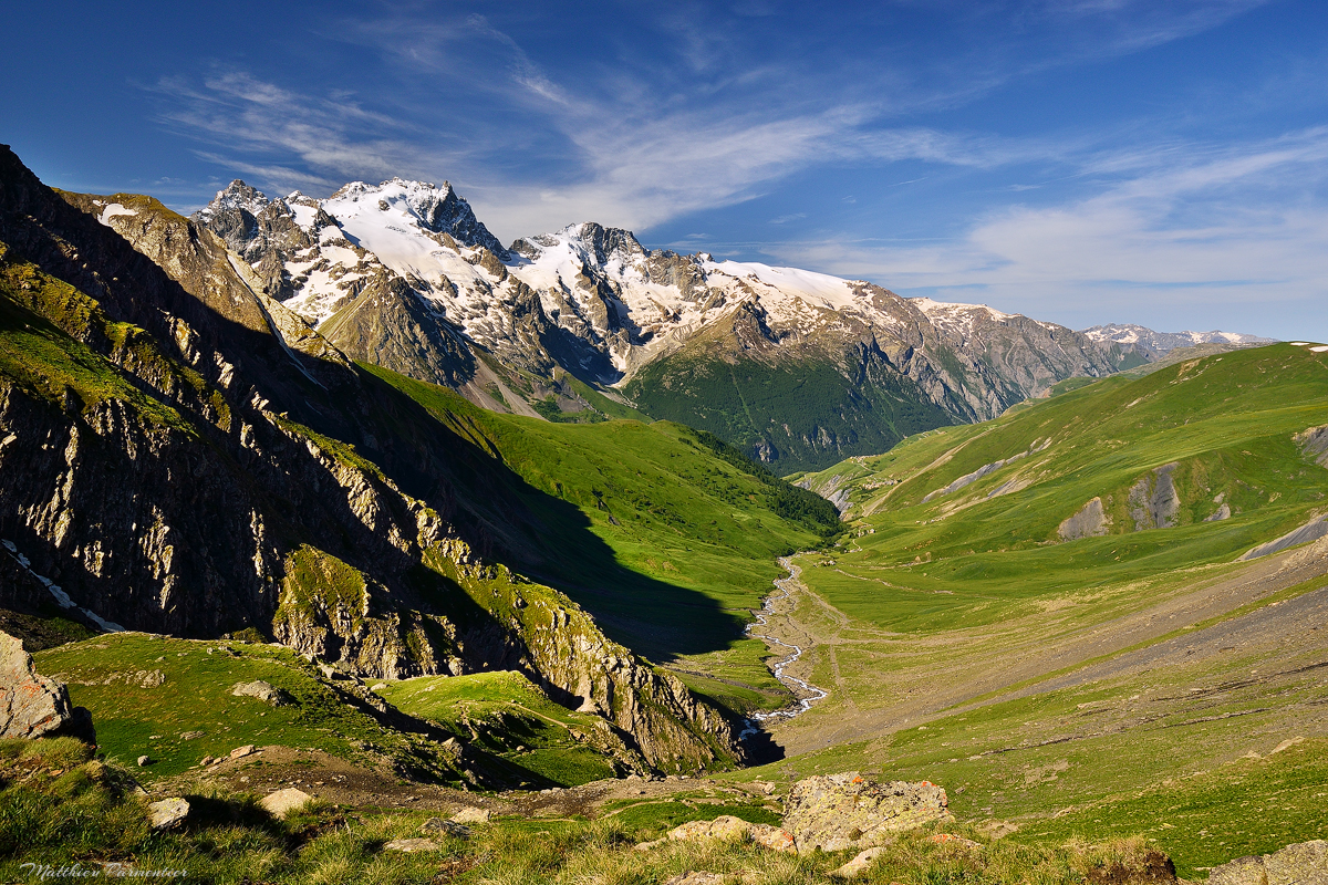
At mid june there were still a lot of snow arround the lake so I decided to go up through some grass slopes to enjoy a different view. It gave me the opportunity to see the valley behind the lake from above… and what a view ! It seems that through Le Serret des Monts and the Replat d’Amont there is a path that leads to the Aiguilles d’Arves : I will explore it next time in summer when I will go back with the kids, for sure.
As you can imagine after reading all I wrote about this hike and the area around the Goléon lake, it is a “top one” to me. A perfect place to enjoy wild mountain and big views, and a perfect hike to try a night in altitude with kids. We didn’t really experience the refuge but had a drink at its terrace and it looked very nice too. A perfect place in every way.
Information
- Departure : Valfroide (or Les Hières in summer)
- Altitudes : 1880m (Vafroide) or 1780m (Les Hières), 2438m (Goléon lake)
- Elevation gain : 560m (Vafroide) or 660m (Les Hières)
- Duration : 1h30/2h00 (30 min more from Les Hières)
- Date : june 2019
- Mountain range : Arves
- Outside any park
Map
You might also like