• Hiking
  • Travel
  • Gear and tips
  • About
  • Contact
  • Behind the lens
  • Photos
    • The autumn kingdom of larches
    • Old growth forests of Canada
    • Dolomites, the European rockies
    • Mountains lakes
  • Français
  • About

    Hiking, photography, wild camping, travels, van… Here are all the subjects that we be broaching here on Awaiting Outdoors. Hope you will enjoy it !

  • Tags

    Alps (14) Arves (2) Behind the lens (3) Big trees (3) British Columbia (3) Canada (3) Car gear (1) Cerces / Clarée / Thabor (2) Configuration (4) Difficult (1) Dolomites (5) Easy (3) Ecrins (2) Forest (3) France (9) Gallery (1) Grandes Rousses (2) Iceland (1) Italy (5) Mountain (14) Normal (1) Renault Trafic (4) USA (1) Van (4) Vancouver Island (3) Vanoise (2)
  • Hiking
  • Travel
  • Gear and tips
  • Behind the lens
  • Photos
    • The autumn kingdom of larches
    • Old growth forests of Canada
    • Dolomites, the European rockies
    • Mountains lakes
  • Français
  • English

Ouillon mount and Guichard lake

3 February 2022

Mount Ouillon is not a spot I knew before 2020 when we spent a couple of days around Saint-Sorlin d’Arves. The thing is that we stayed a night at Lake Laitelet – just under the Col de la Croix de Fer – where we met my father who was also travelling in the Alps at that time. In the morning after we decided to wake up early together to go on top of a summit to see the sunrise and do a quick “father and son” hike.

When I first checked on Altitude Rando I didn’t thought the view will be so nice. The hike is crossing some skiing infrastructures a few times so it is not as wild as I like but once on the top I can assure you that it is worth the steep ascent.

The hike starts on a small track on the other side of the road when parking at Lake Laitelet. It goes straight in the mountains and steeper really quickly. There is no rest or flat portion on the ascent so be prepared for a 400m of elevation gain in something like 1 hour.

The Etendard mount and glacier seen from the Mount Ouillon
On top of Mount Ouillon. On the right the Arves needles

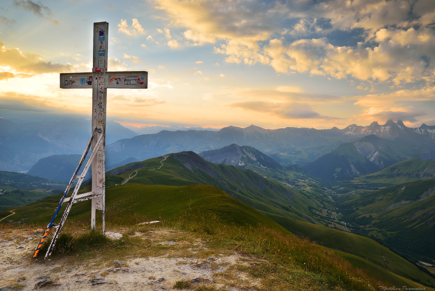
The little story behind the ascent is that I was 40 at the time of the hike and my father is 24 years older than me. I remember I started the first and hiked quickly to be sure to be on top for the sunrise. I really didn’t take any specific rest and I was impressed to see him following me the whole ascent without any distance between the two of us.

It made me thought that yes, you can be 64 and still hike like this I you take care of yourself like he always do. At that age he is still a better hiker than many young people. A nice life lesson !

Above Saint-Sorlin d’Arves. The lake on the bottom right is the one from which we started the hike
The perfect view : the Aves needle on the left and the Ecrins on the right

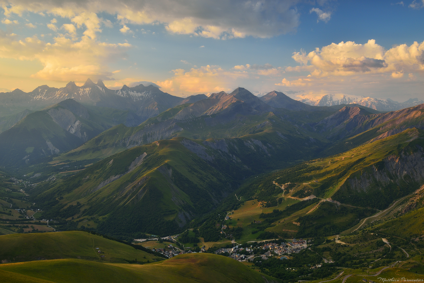
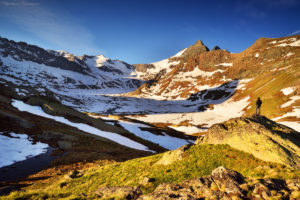
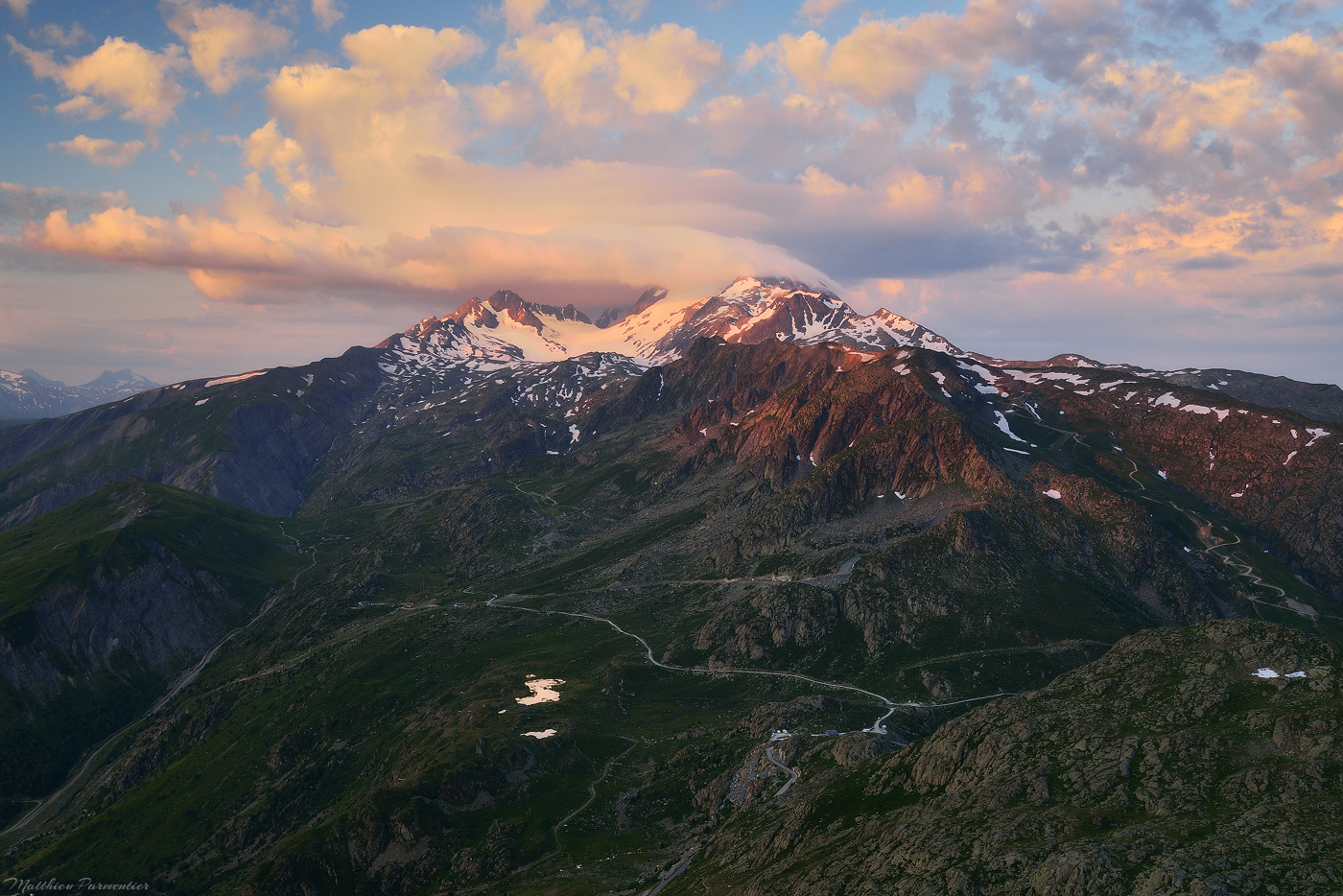
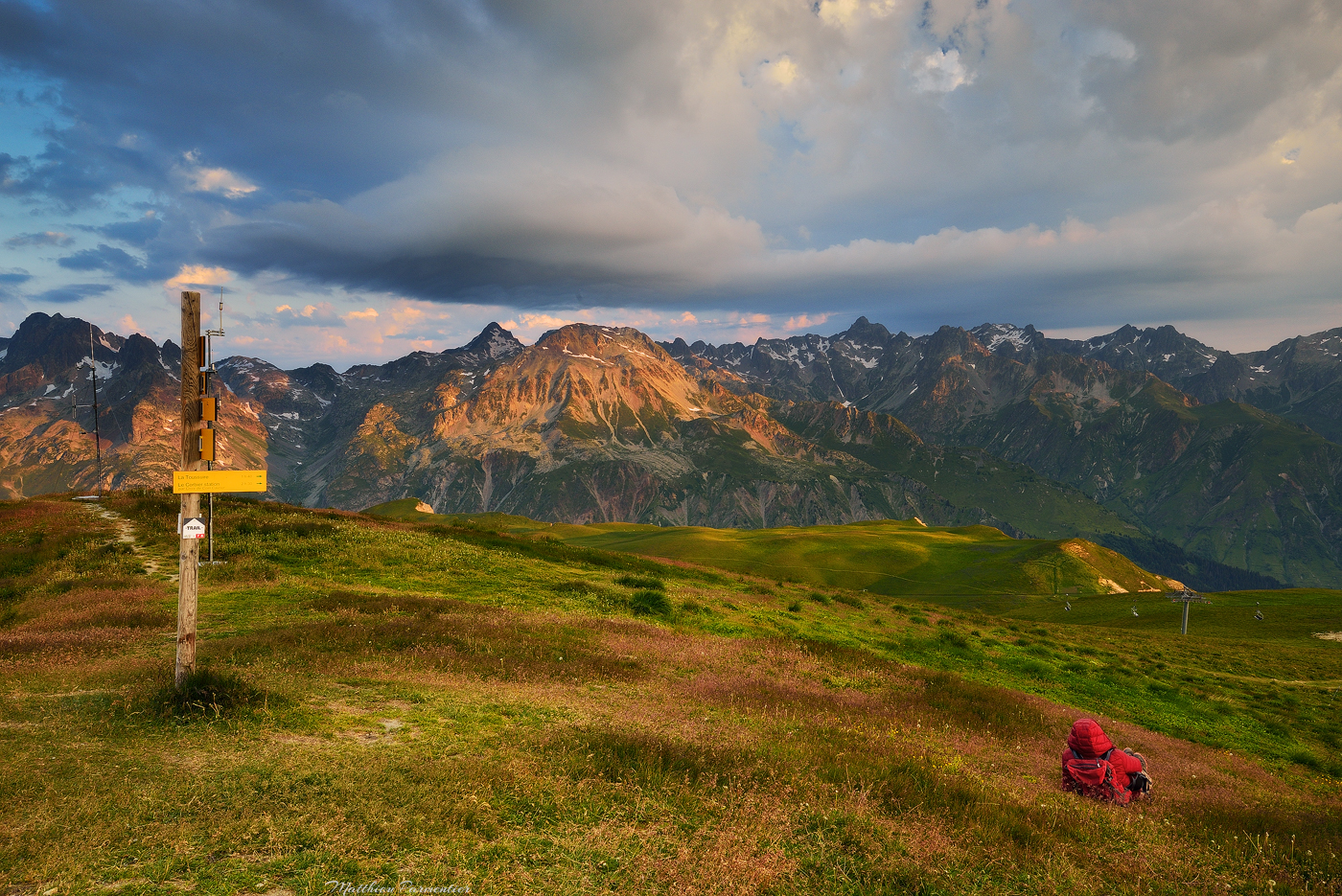
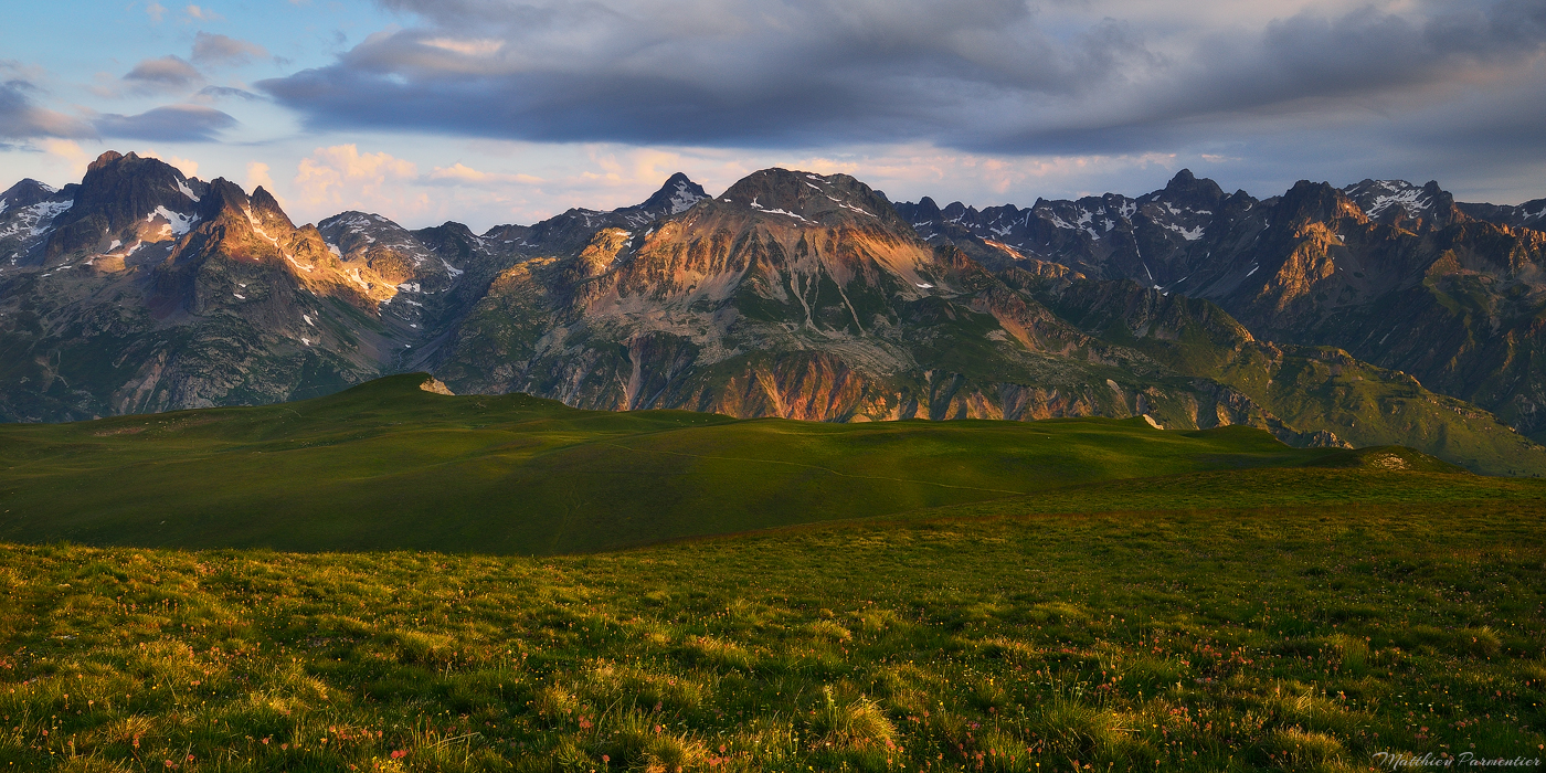
Once on the top just don’t mind the antenna or the skiing infrastructures of Les Sybelles on the other side and turn in the direction where you came from : you will enjoy an incredible view on the Arves needles, the Etandard glacier and far away on the Ecrins National Park.

That day the weather was hot so I was not sure that the sunrise would be nice but it was : nice colors and high clouds perfects for this long distance view.

My father having a rest in front of Belledonne mountains
Zooming to the lac Laitelet, starting point of the hike

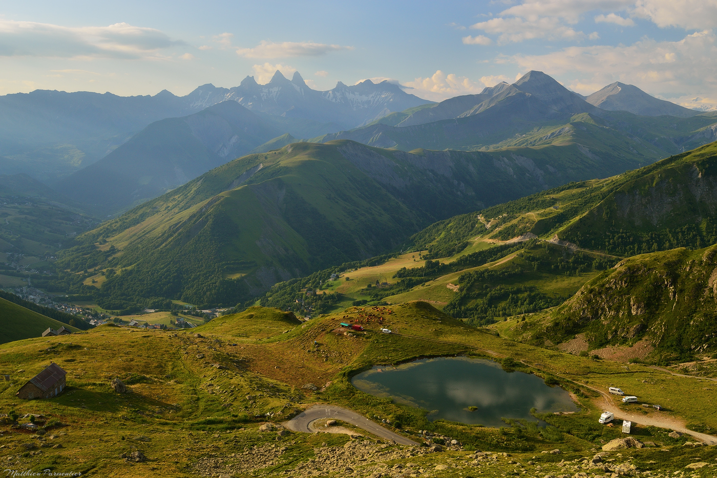
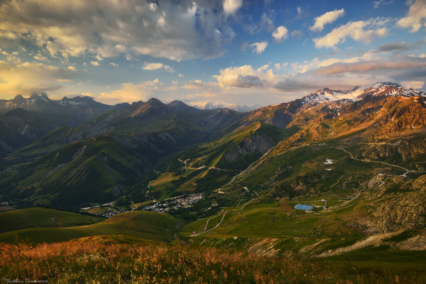
After a nice photo session and a rest we continued hiking on the other side along the skit lifts and after a while took a easy track that goes through nice fields to the pass Col de la Croix de Fer. This part is less challenging and is almost flat for a long time.

After something like 45 minutes along the impressive Belledonne mountains range (see the picture below) you will arrive to the pass. Once there you can go back to the Laitelet lake by the road or go to the Guichard lake, an incredible spot easily visible from the pass.

Belledonne mountains on our way from the Mount Ouillon to the Guichard lake
The Guichard lake and its view on the Arves needle. Always a lovely place to visit.
Another one from the Guichard lake

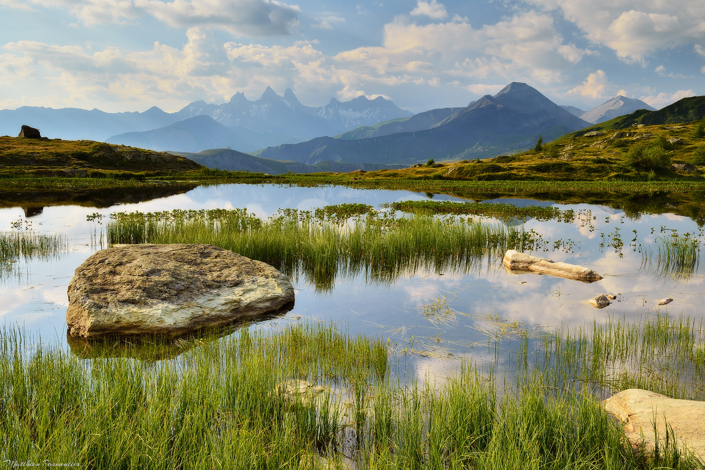
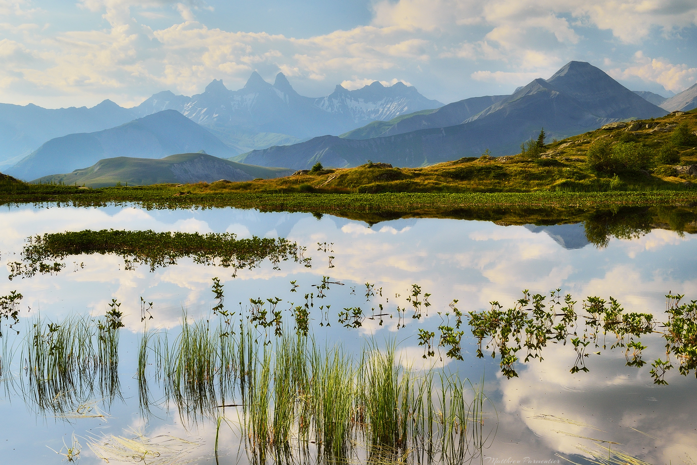
The Guichard lake is one of my favourite places in the Alps. You don’t need to hike more than 10 minutes to reach it and if you won’t have the same feeling you get when you reach a lake after a long hike, the view and the surroundings are so incredible that it is a must-see everytime you’re in the area.

I think the pictures of the lake speek for themselves, and if you want to try a nice camp with friends or family I can assure you that it is a perfect place (I slept there a couple of times in the past).

After the lake, follow the track on the left (when you look at the Arves needles) and in something like 20 minutes you will be back to the Laitelet lake. The whole hike takes arround 2h30 (less or more) : it is not the best one of the area, but it is an easy and nice one to do, especially if you want to see a view of all the famous mountains around.


Information

  • Departure : Laitelet lake
  • Altitudes : 2035m (lake), 2431m (mount)
  • Elevation gain : 400m
  • Duration : 2h30 the loop
  • Date : july 2020
  • Mountain range : Grandes Rousses
  • Outside any park

[ The hike track is the blue one ]

0 0 votes
Article Rating
AlpsArvesEasyFranceGrandes RoussesMountain
Share

Hiking

matthieu

You might also like

American Rockies
17 May 2022
Behind the lens #3 – Autumn splendor
27 January 2022
Monte Pore
16 June 2021
Subscribe
Connect with
I allow to create an account
When you login first time using a Social Login button, we collect your account public profile information shared by Social Login provider, based on your privacy settings. We also get your email address to automatically create an account for you in our website. Once your account is created, you'll be logged-in to this account.
DisagreeAgree
Notify of
guest
Connect with
I allow to create an account
When you login first time using a Social Login button, we collect your account public profile information shared by Social Login provider, based on your privacy settings. We also get your email address to automatically create an account for you in our website. Once your account is created, you'll be logged-in to this account.
DisagreeAgree
guest
0 Comments
Inline Feedbacks
View all comments
  • Languages available

    • FrançaisFrançais
    • EnglishEnglish
  • Instagram


  • Also on Awaiting Outdoors

    • Renault Trafic configuration for a family of 4 – Part 2/3

      Renault Trafic configuration for a family of 4 – Part 2/3

      On the first post about our Renault Trafic configuration, I told you …
    • Isolated stores for a Renault Trafic van

      Isolated stores for a Renault Trafic van

      I’m coming back online with a couple of posts about our van …
    • The sanctuary of Meares Island

      The sanctuary of Meares Island

      Right after the Giant cedars of Canoe Creek we headed South-East to …
    • Scotland

      Scotland

      First post of the “Travel” section. For this one I choose to …
    • Carro mountain hut

      Carro mountain hut

      The Carro refuge is the highest of the Vanoise National Park. The …


  • Tags

    Alps (14) Arves (2) Behind the lens (3) Big trees (3) British Columbia (3) Canada (3) Car gear (1) Cerces / Clarée / Thabor (2) Configuration (4) Difficult (1) Dolomites (5) Easy (3) Ecrins (2) Forest (3) France (9) Gallery (1) Grandes Rousses (2) Iceland (1) Italy (5) Mountain (14) Normal (1) Renault Trafic (4) USA (1) Van (4) Vancouver Island (3) Vanoise (2)
  • Awaiting Outdoors

    • About
    • Contact
    • Photos
  • Mountains ranges

    • Arves
    • Dolomites
    • Ecrins
    • Grandes Rousses
    • Vanoise

© Copyright Awaiting Outdoors

wpDiscuz